Do you ever find yourself faced with that all too dismal
weather forecast with the weekend approaching, while trying as you will to
secretly convince it to improve as you religiously check the forecast each day
counting down to the weekend only to be forced to succumb to the 100%
prediction that YES, it actually will be raining today?? Well Saturday and the
week leading up to it was exactly that kind of forecast for me. However I
didn't let that ruin my hefty ambitions to get back into the mountains to soak
up some of that magical energy that it gives out to those willing to embrace
the challenges it has to offer. I did however question my ambitions as I
approached Scott Lake Hill on the Trans Canada Highway only to find myself
entrenched in a 'high' speed wiper downpour that had darkened the skies to an
almost dusk like feeling that was trying to pull what was left of my wavering
ambition out of me and toss it out the window!
But with some knowledge and experience from my years spent exploring in
the mountains I knew there would be a chance I could maybe rely on one of those
micro systems that often float in out of the valleys like pinballs off of the
peaks to allow me to pull off some kind of adventure. If anything a trail run
in the light drizzle would even suffice to fulfill my desire for some of those
sought after mind altering endorphins that occupy the mind after such
adventures have been carried out. As predicted, or shall I say,
"hoped", the micro systems of weather afforded me safe passage to my
objective Mount Burstall which rises up from 6135' at the trail head to 9055'
at it's summit which was stuck in clouds when I arrived. However despite the
mixed weather of the day I was fortunate to be allowed safe passage up the
mountain to experience some of the most spectacular scenery the Rocky Mountains
have to offer. Unfortunately my camera skills do not extend much further than
the 'auto' function on the camera but I did manage to get some decent shots
despite the lack of any definitive sunlight that day, and I did top up on those
endorphins I spoke of earlier which at the end of the day was really my
ultimate goal regardless of any photo evidence that these events ACTUALLY
unfolded!!
Enjoy the photos. I took lots as it was just one of those
days where the clouds were constantly in and out of the valleys, but with a
little patience waiting on the relatively small summit of the peak I was able
to capture the magnificence of the views (although never quite like being there
:) that I was fortunate to see.

Spillway Lake with Mount Wintour in the background

Mount Black Prince

Mount Black Prince with nice fall colours on it's north shoulder

Starting the trail to Mount Burstall which was still in the clouds

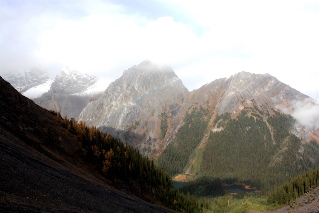
Commonwealth Peak on the left, one of the Burstall Lakes below it
Half way up the approach slopes to the col below Mount Burstall looking back
down into the valley

Cauliflower Fungus. Love the florescence of this fungus!

Common Wolf; Wolf Lichen
 My objective Mount Burstall with the clouds just starting to thin out
Mount Burstall above with the French Glacier WAY in the back

Looking down a gully from the col to the Burstall lakes and Burstall Pass trail below

Visibility GONE below me!

Crux of the scramble just above me

Ridge leading up to Cegnfs Peak and Mount Murray on the right. Cegnfs Peak was named after the initials of the first ascentionists so it really doesn't make much English sense!

Looking back down the scramble route to the col. Spray Lakes road can be seen far below

Commonwealth Peak right, just touching the clouds, with Mount Birdwood left, buried in cloud

Looking back at the crux of the scramble

Two Summit cairns on Mount Burstall

Looking directly south at the French and Robertson Glaciers engulfed in clouds

Summit selfie on Mount Burstall

Looking directly west at Snow Peak with the snow coming down

Mount Birwood left, just coming out of the cloud. Pig's Tail (Sharks Tooth) on the right

L to R - Snow Peak, Mount Birdwood, Pig's Tail, and the
west shoulder of Commonwealth Peak

The impressive Mount Birdwood with the even more impressive
Mount Assiniboine poking out of the clouds on the left

9107' (2776m) Cegnfs fighting off more cloud

9917' (3023m) Mount Murray also fighting off more cloud

9104' (2775m) Commonwealth Peak

French Glacier left, and Robertson Glacier right, just coming into view again

Impressive terrain around Mount French, Mount Robertson,
and Mount Sir Douglas on the right

Snow Peak, Birdwood, and a different angle on the Pig's Tail

French Glacier in the center with Mount French on the left and Mount Robertson on the right

French Glacier

Robertson Glacier with Mount Robertson on the left and Mount Sir Douglas on the right

Robertson Glacier

11,175' (3406m) Mount Sir Douglas unable to escape the clouds

Mount Assiniboine just poking through the clouds

The 11,844' (3618m) impressive Mount Assiniboine

10,158' (3097m) Mount Birdwood in all her splender.

Looking west to the Burstall Pass area

Nice shot of Birdwood, Sharks Tooth, and Commonwealth Peak
from the summit of Mount Burstall

Another selfie with the French & Robertson Glaciers in the background

Another nice shot of the Robertson Glacier with Mount Robertson left
and Mount Sir Douglas on the right

Looking across the valley at the Kananaskis Range with Chester Lake near the middle

Mount Galatea center, with Chester lake below it. Mount Chester on the right

Mount Galatea left, Chester lake buried in the trees below, The Fortress
towering in the back on the right

On the way back down to the col below Burstall

Nice fall colours contrast at the col

Ridge extending from the col with the Spray Lakes road in behind

Colourful lower Burstall Lake

Spray Lakes Road leading to the Spray Lakes with Mount Nester rising behind

Descending Mount Burstall with the black scree slopes dropping down off the col

Descent slopes from the col back to the trail above the Burstall Lakes

Upper Burstall Lake

Larches in their splendor above the French Creek Valley

More Larches above the French Creek Valley

Looking back up at Mount Burstall now from the NE ridge opposite Burstall above the col

Another nice shot of Peak Cegnfs

Another nice shot of Mount Murray

Water coming in to the Middle Burstall Lake

Black scree slopes lead back down from the col to the Burstall Pass trail

Nice shot of the valley upstream of the Upper Burstall Lake

Dotted Saxifrage (out of flower). One hardy alpine plant!

Clouds moving back in again to the col

Another hardy rock plant. Unidentified

Moss Campion

Moss Campion, out of flower, hosting a place for other life to grow

Small waterfall coming out of the Middle Burstall Lake

Commonwealth Peak above Middle Burstall Lake

Middle Burstall Lake

Stiff Clubmoss

Interesting rock feature above Galatea trailhead
 |
| Unnamed Peak near the Galatea parking lot and trailhead |

Wedge Pond below 'The Wedge ' left, and Limestone Mountain center

Wedge Pond. Soil excavation site for the Kananaskis Golf Course early 1980's.
33,000 truck loads of soil were taken out. The pond is now maintained
by Kananskis parks and stocked with Arctic Grayling

Cicer Milkvetch

Seeds shake around in these hardened pods. This plant is used in cattle graving.

Bluebell Bellflower hanging in there through the fall

Mount Sparrowhawk back left, Mount Allan (Nakiska) center, and Mount Collembola right

Mount Lorrette and the sun now shining! What an amazing day :)
No comments:
Post a Comment