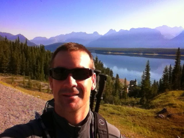
Woke up this morning at 06:30 and the first thing that entered into my mind shortly after my eyelids folded up was "Hmmmmmm.... what should I get up to today? Hmmmmmm....why not go for a big hike!" Five minutes later after trying a phone call to my girls I was up, dressed, and down in the basement gathering the goods I'd need for a light daypack (bear spray included) to stay safe yet as light as possible for a long hike into the backcountry. Without even taking the time to manufacture a proper sandwich, I had a Safeway grocery bag stuffed with a package of preservative free Italian Style ham, a bag of Anni's animal cookies, a few odds and ends of fruits and veggies, plus the interestingly weird jelly treats that a curios Chinese lady had given to Anni on the bus ride in from our past recent trip into Lake O'Hara.
Now these little babies pack a pretty good energy punch by the way! So I may have to track some down for future trips. (Can't even be too sure what's in these little treats since the label is in Chinese character but I'm alive this morning so it couldn't have been too bad!!)
With the back pack stuffed and a tea in one hand and a half full container of yogurt with bananas in the other, I was hitting the button on the garage door opener at 07:00 and setting off on my days adventure.
Still a little unsure of my exact objective for the day the basic area and trail system was secure in my mind so I made the always important phone call to Kärolin and mom to let them know my plan for the day with the promise of an email and a phone call upon my safe return at the end of the day. Little did I know (actually who am I kidding?!!) that I was about to open up a Costco sized can of whoop-ass on myself with a 34 km hike with 525m (1722') elevation gain and loss! So with my energy feeling good, and summers lengthy bright smile on my side, I dipped my spoon into the can and served myself up a very HEALTHY portion!! Mmmmm.........mmmm....delicious!!
It actually went quite well considering my over-the-hill age of nearly 41 although the struggle between mind and body started to challenge me about 10 km's back as I started the steep decent into the Forks campground 7 km's from the car. Luckily I have ample experience with this kind of challenge and I've learned how much more powerful the mind is than the body in these cases so I was easily able to convince my body that it could do it and how good it would feel after recovery in the days to come. So with a solid push through to the Forks I arrived to the communal cooking area and was greeted by a couple from Bashshaw, Alberta who I had encountered earlier on in the day along the trail towards Turbine Canyon. After a nice chat and a top up on some natural sugars from a lustrous white nectarine and black plum I was re-energized and back on the trail to finish up the final 7 km's to reunite with Snowflake at the Interlakes parking lot.
It always amazes me how the body starts to really feel the fatigue and shut down as you enter into that final kilometer stretch to the trailhead. It must be the minds anticipation saying, "phewww, we've done it, were going to make it!" Then the body picks up on this energy from the mind and starts to go into relaxation mode. Only it forgets that there is still another kilometer to go and without the mind TELLING the body, "hey wobbly legs, tighten up those fibers, tendons, and muscles so that you can finish up the task at hand!" you start to feel like a walking piece of overcooked spaghetti at this point!!
Anyway... I made back without incident and as I saw Snowflake blink at me after pressing her remote unlock button, I saw 2 other groups of hikers arriving back at THEIR specially named vehicles with similarly heavy, noodle like footsteps barely preventing their inevitable collapse into the car seat; so I knew I was in familiar company and it put a collective smile on my face to have completed an absolutely fabulous day in the mountains equally shared with like minded others. :)
Just of note: on this trip I set off without my trusty Canon SLR so I was only equipped with my iPhone 4s to try and capture the beauty of this magnificent area. All in all I don't think the photos turned out too bad, however there were a few moments and captions missed because I didn't have the zoom lens to stop short on some pretty neat wildlife sightings or zoom in on distant features. Therefore I wasn't able to capture the pika's I saw, an actual 'decent shot' of the grizzly bear, and my first sighting of a long-tailed weasel who crossed the trail in front of me with a mouse for dinner securely clamped in its jaws. Anyway....it's nice a lot of times to just have those little moments to yourself to awe in the splendor of mother natures wonders and those chance encounters that can so easily pass you by. Enjoy!
.JPG) |
| Juvenile Grizzly by the Interlakes campground. |
.JPG) |
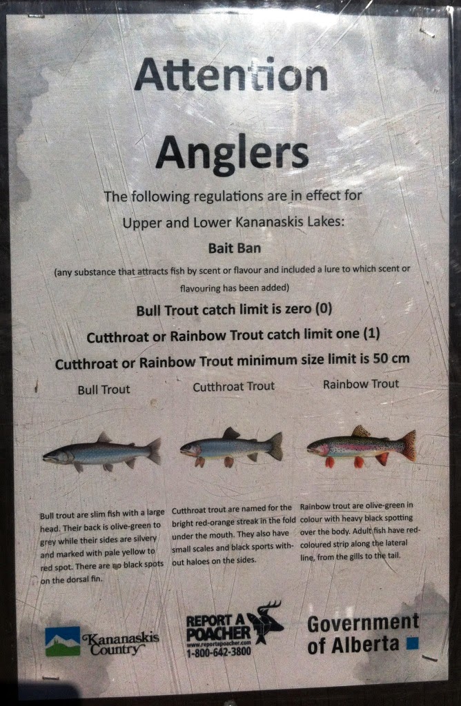
| Fish in Upper Kananskis Lake for reference. |
.JPG) |
| Lower Kananaskis Lake from the dam. |
.JPG) |
| Upper Kananaskis Lake from the dam. |
.JPG) |
| This is a really nice hike/scramble. I was fortunate to have the chance to hike it a couple of times before the voluntary closure. |
.JPG) |
| The Russians are watching us! |
.JPG) |
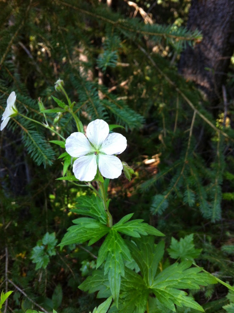
| Richardson's Geranium (Geranium richardsonii) |
.JPG) |
| Poke Weed Berries |
.JPG) |
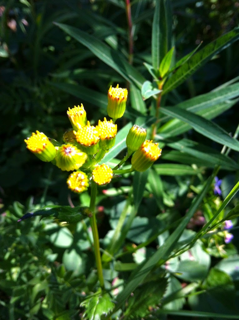
| Common Groundsel Weed (Senecio vulgaris) **POISONOUS** |
.JPG) |
| Nodding Onion |
.JPG) |
| Shrubby Cinquefoil |
.JPG) |
| Spearleaf Stonecrop (Sedum lanceolatum) |
.JPG) |
| Common Fireweed. This plant is so vibrant in colour! |
.JPG) |
| This is a photogenic tree that many hikers have posed in for a picture. Backpack got the honors this time :) |
.JPG) |
| Mount Sarrail (10,414') towering in behind Upper Kananaskis Lake |
.JPG) |
| Dotted (or Spotted) Saxifrage (Saxifraga bronchialis) |
.JPG) |
New Bridge crossing Invincible Creek after the June 2013 floods destroyed some sections along
this stretch of the Three Isle Lake trail. |
.JPG) |
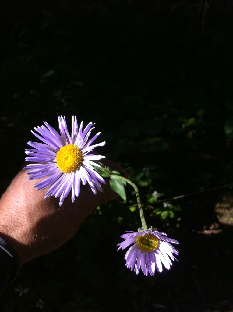
| Showy Fleabane Daisy |
.JPG) |
| Showy Fleabane Daisy with 4 flowers about to open up. |
.JPG) |
| Looking upstream on the Kananaskis River |
.JPG) |
| New bridge here as well above Upper Kananaskis Falls on the Kananaskis River |
.JPG) |
| Liverleaf Wintergreen |
.JPG) |
| Black Twinberry |
.JPG) |
| Black Twinberry |
.JPG) |
| Xanthoria Parientina or Common Orange Lichen growing on the limestone. |
.JPG) |
| Another rebuilt bridge (basic one) to replace the damaged bridge crossing Three Isle Creek. When the June 2013 flood came through, there were a handful of stranded campers at the Forks campground that had no way out except the helicopter rescue. That would have been a frightening experience for those people! |
.JPG) |
| Many trees simply fell into the Kananaskis River as it carved out a wider path from its swollen levels a year ago. |
.JPG) |
| The Kananaskis River flows below this timber! |
.JPG) |
| Orange Agoseris (Agoseris aurantiaca) |
.JPG) |
| Goldenrod flowers that haven't quite popped. |
.JPG) |
| Splitleaf Indian Paintbrush |
.JPG) |
| Pink Mountain Heather |
.JPG) |
| White Pasqueflower aka: Towhead Babies in the seed stage after flowering. |
.JPG) |
| Looking through a gap to Mount Putnik (9,646'). |
.JPG) |
| This small pass held an amazing surprise as you emerge from the forest trail after quite some time to an amazing vista! |
.JPG) |
| The valley opens up and you see quite a ways to the north along Mount Black Prince (9,620') on the right. |
.JPG) |
| An unnamed pond after what I call, 'Vista Pass'. |
.JPG) |
| You can see all the way to the Mount Jellicoe (10,650') the large peak left of center in the photo. |
.JPG) |
| Looking back at Mount Putnik with the tiny 'Vista Pass' in the center with a faint trail leading up to it. |
.JPG) |
| American Alpine Speedwell |
.JPG) |
| Lawson Lake |
.JPG) |
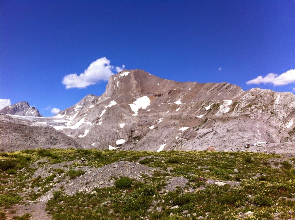
| Lawson Lake. The Haig Glacier can be imagined in behind the triangle shaped peak of Mount Maude (9,981') My goal for the day was to reach the Haig Glacier and see the ski camp. |
.JPG) |
| Old bear scat, don't worry. |
.JPG) |
| The alpine flowers were just gorgeous alongside much of the trail where it opened up. |
.JPG) |
| Lawson Lake again. |
.JPG) |
| Maude Brook shortly before it plummets some 300 feet into the canyon floor. |
.JPG) |
| Looking relatively gentle at this point. |
.JPG) |
| Maude Brook simply slides away into this narrow chasm called Turbine Canyon. |
.JPG) |
| He you see a smooth, water worn limestone bed formed by this small outflow of the Haig Glacier. Turbine Canyon drops away through the near rock cut. |
.JPG) |
| A vertigo picture looking over the edge into Turbine Canyon. |
.JPG) |
| It is difficult to capture the magnitude of this impressive drop. |
.JPG) |
| On the edge. |
.JPG) |
| Just about to pop over this glacial moraine to get a view of the Haig Glacier. Mount Jellicoe towers in the back right. |
.JPG) |
| Alpine Forget-me-nots. One of my favourite mountain flowers. |
.JPG) |
| They remind me of the blue hoody Kärolin wore on her first trip to Canada. She looks really nice in this colour. |
.JPG) |
| Looking back to the south over Lawson Lake from the moraine. Mount Beatty (9,840') and the Beatty Glacier can be seen on the right. |
.JPG) |
| Finally able to ID this plant! They have a very short flowering season. |
.JPG) |
| Drummonds Anemone |
.JPG) |
| Mount Jellicoe above the ski camp facility. |
.JPG) |
| Becky Scott High Performance Training Center where Canada's elitist young athletes go to train during the summer months for x-country skiing. |
.JPG) |
The toe of the Haig Glacier.
|
 |
| I found this photo from the internet of the Haig Glacier as viewed from the col on the French Glacier. Lawson Lake can be seen in the background. It understandable why they chose the Haig Glacier for ski training because of its overall mass, relatively flat area, and little to no crevasse hazards. |
.JPG) |
| Could be Canada's future x-country ski team! These youngsters, with their coaches, do the 17 km hike in to camp as part of their training program. |
.JPG) |
| Beautiful vistas of Lawson Lake. |
.JPG) |
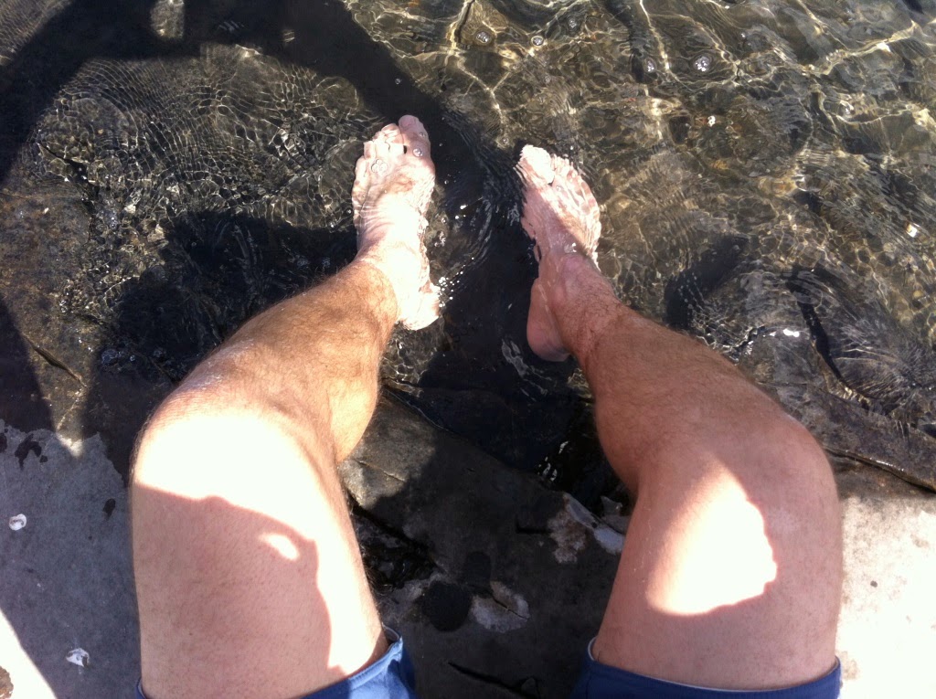
| Cooling down some swollen feet in preparation for the final 13km's back to the car. |
.JPG) |
| Approaching 'Vista Pass' from the north this time on my way back down. |
.JPG) |
| Mount Putnik through this notch in the forest. |
.JPG) |
| Unnamed creek flowing down from the mountains above. Likely an outflow from the Beatty Glacier. |
.JPG) |
| The trail that climbs/descends to the Forks campground, Mount Putnik in behind. The trail back to Interlakes goes behind the treed should in front of Mount Putnik. |
.JPG) |
| Alpine Helicopter with pilot Paul Maloney doing some work for Alberta Parks stocking up the firewood at the backcountry campgrounds and flying out the honey buckets. |
.JPG) |
| Canadian Buffaloberry |
.JPG) |
| Buffaloberry/Soapberry |
.JPG) |
| Backside of Mount Indefatigable showing the rock climbing route 'Joy 5.4' following the big fracture of slab in the center of the photo. |
.JPG) |
| Boy and his dog on the island (difficult to see in the photo) |
.JPG) |
| Cow Moose |
.JPG) |
| Cow Moose |
.JPG) |
| Gray Fox |